
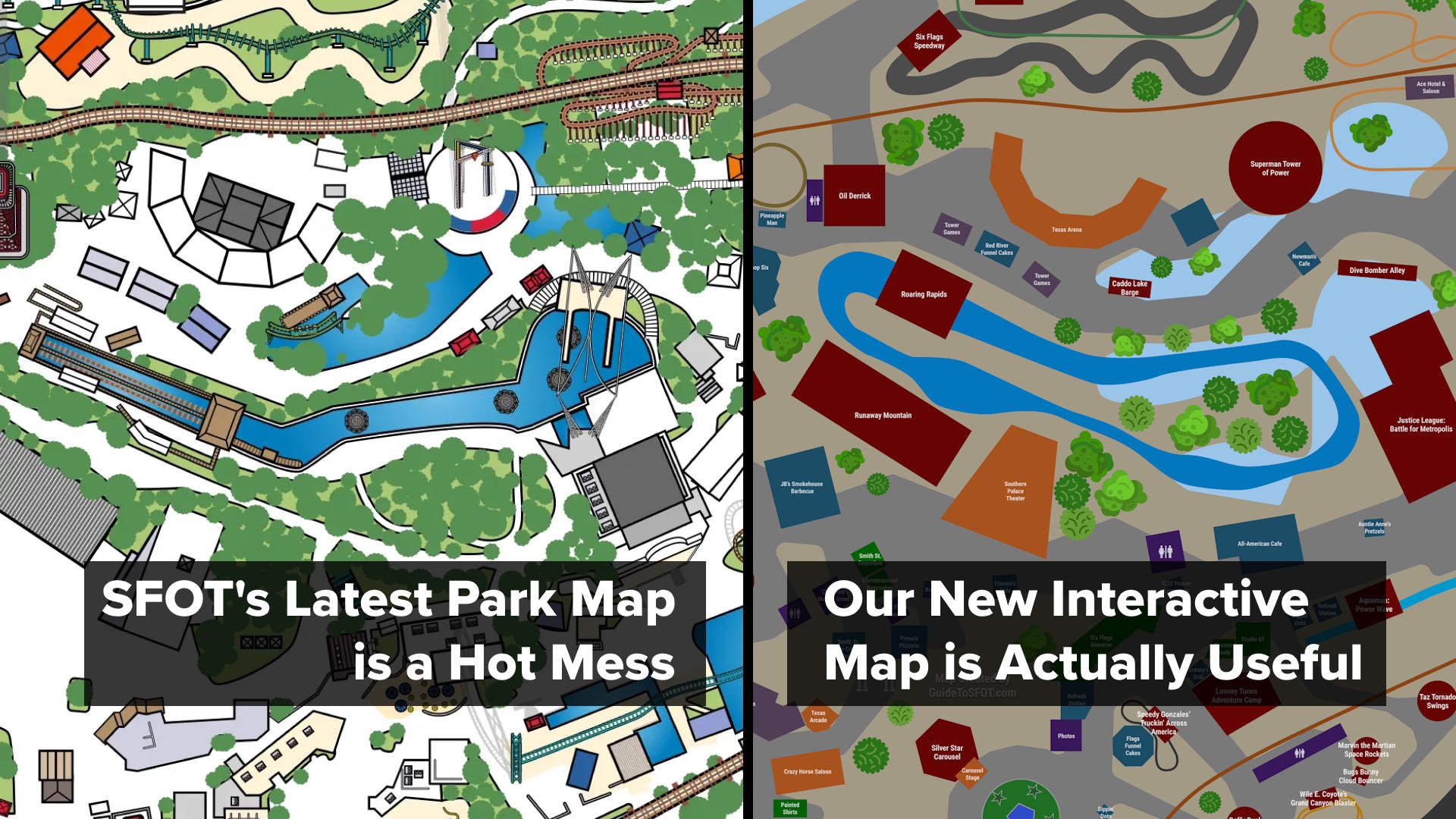
The purpose of a theme park map is simple: show guests where they are, where the attractions are, and how to reach them. After all, maps are primarily used by guests unfamiliar with the park's layout who need clear direction.
But what happens when a theme park map is so bizarrely riddled with errors and inaccuracies that it fails at those basic goals? When those inaccuracies go far beyond the usual map simplifications made for clarity and instead become a distraction?
In our opinion, that’s exactly the situation with Six Flags Over Texas' official 2026 park map. (All images in this article come from the app, which offers a higher‑resolution version than this park guide.)
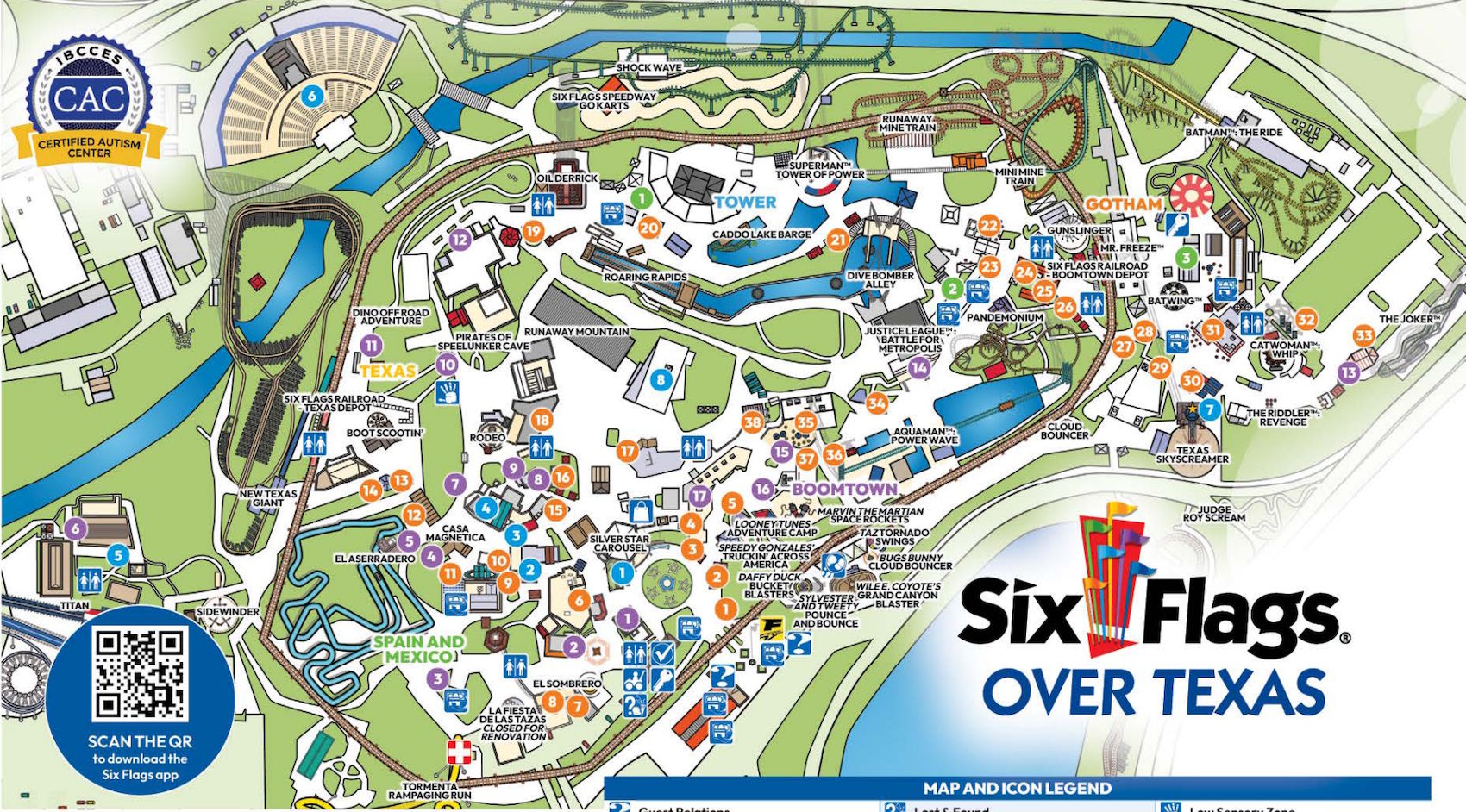
Official 2026 SFOT Park Map
At first glance, it may appear to be a standard, modern take on the park map. But anyone familiar with SFOT will immediately start noticing oddities.
Online communities have already referred to the latest wave of Six Flags maps as AI slop. And there are several reasons to believe Six Flags used a rudimentary AI system to generate SFOT's 2026 map.
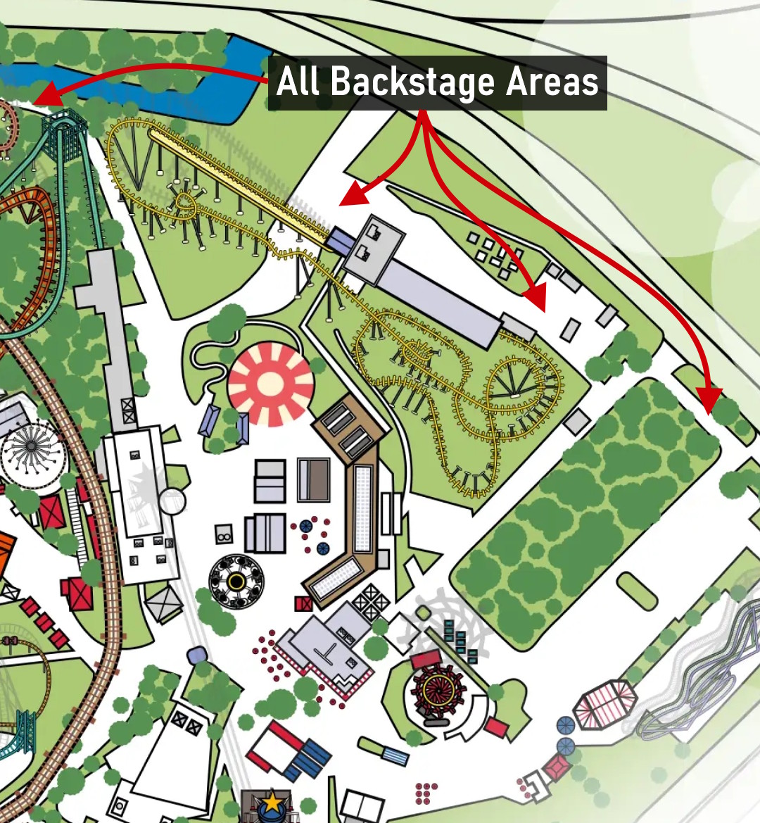
The biggest issue from a usability perspective is that the map includes both guest walkways and employee-only backstage areas, with no distinction between the two. For example, the map's depiction of the Star Mall Entry Plaza shows several backstage areas as being regular pathway that would let you walk directly from the Silver Star Carousel back to Crazy Horse Saloon:
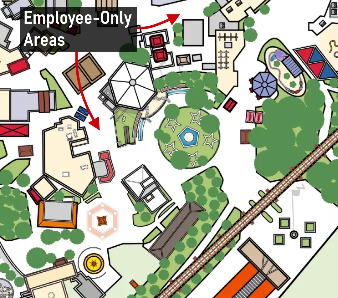
Backstage areas next to Silver Star Carousel mistaken for guest paths
The more you look at the map, the more it appears that whatever system they used simply detected concrete and blacktop in a satellite image and converted all of it into guest walkways — a theory supported by Dino Off Road Adventure’s entire course showing up as a path:
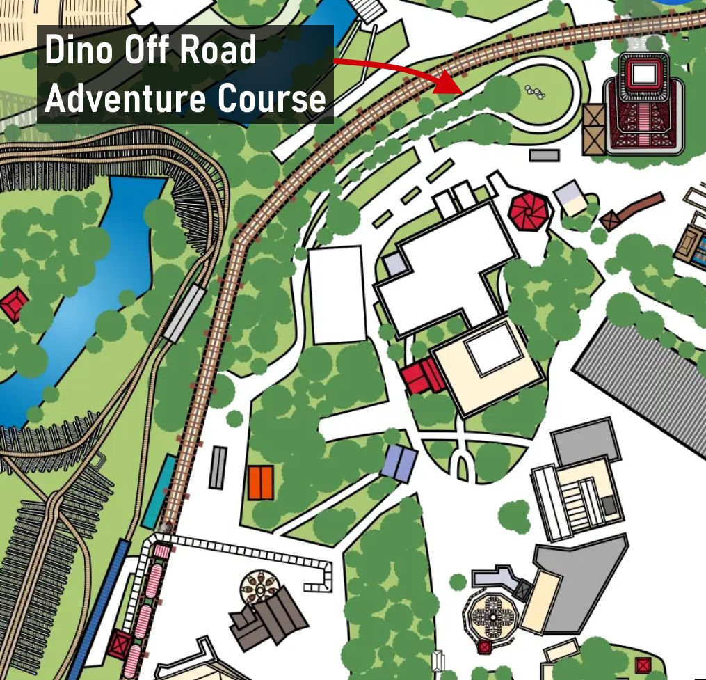
Dino Off Road Adventure's track is misclassified a guest pathway
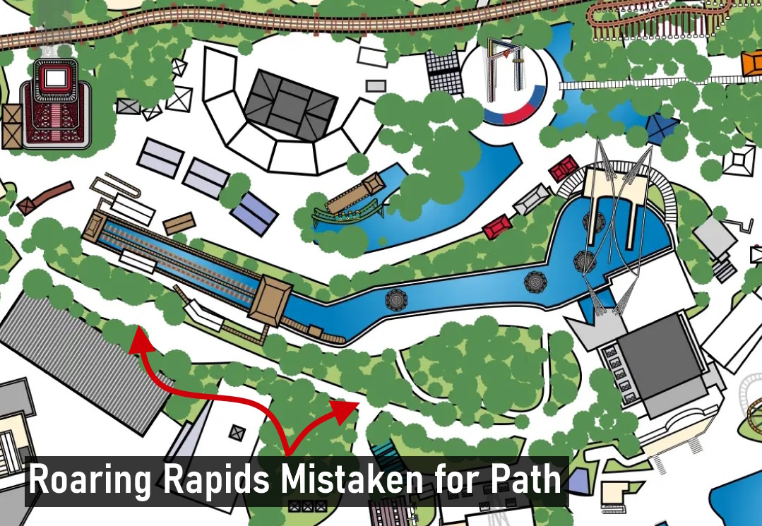
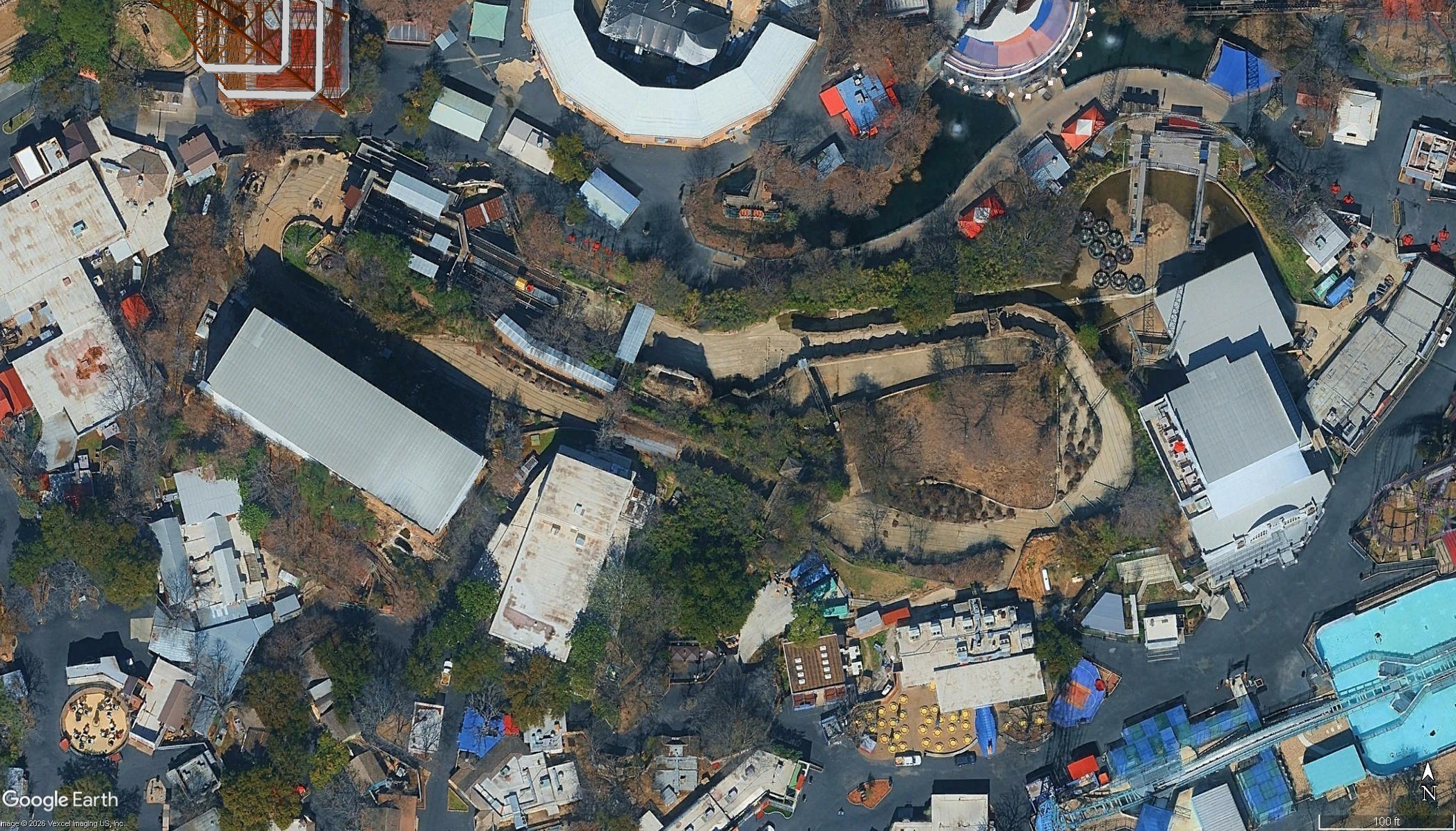
Another interesting giveaway is Roaring Rapids, where half the attraction appears as a water ride and the other half appears as walkways. Most of the "water" shown is actually the low point of the ride where water naturally accumulates when the attraction's pumps aren't running. It certainly seems like an aerial reference image was used from when the ride wasn't running, confusing the map's generator into thinking the waterless parts of the trough are guest-accessible walkways (they're not; please don't try to walk there).
-
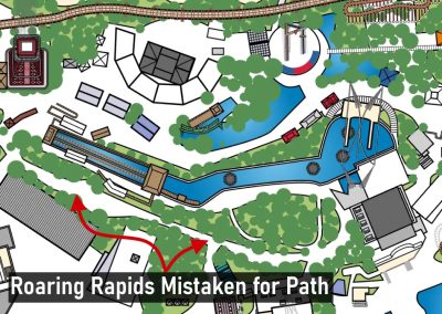
Half of Roaring Rapids is mistaken for guest paths
-
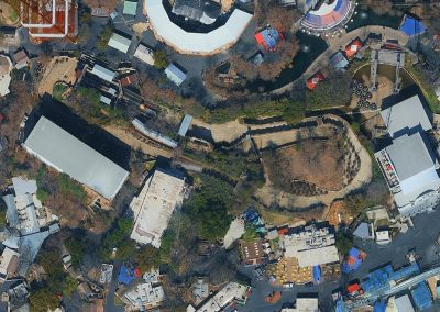
Roaring Rapids Aerial Image from Google Earth
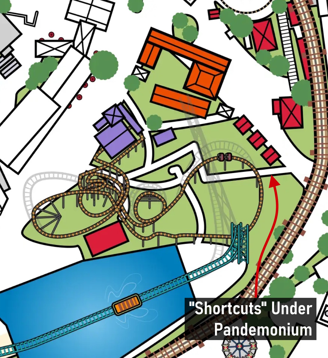
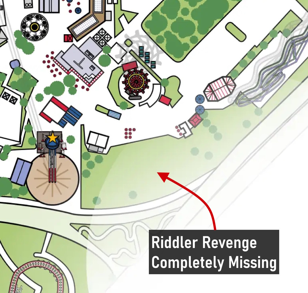
The widespread misrepresentation of any and all concrete as pathways is especially bad in Gotham City, where large backstage areas are again shown as guest paths. Maintenance walkways under Pandemonium are essentially depicted as shortcuts. Riddler Revenge is missing from the map altogether.
-
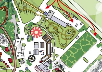
Tons of backstage areas in Gotham City mistook as paths
-
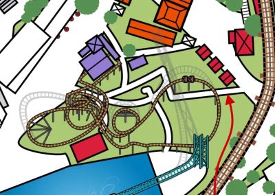
Various park personnel paths under Pandemonium mistaken for guest paths
-
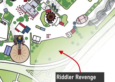
Riddler Revenge is missing altogether from the map
Even the park's new signature attraction Tormenta isn't immune to the weirdness. The park map generally gets the ride's layout right but completely botches its scale and placement, strangely placing the station outside the park when in reality it's right next to El Aserradero. Speaking of the log flume, the map also clearly got confused with El Aserradero's two flumes, combining them into one (perhaps a nod to El Rio Lento, R.I.P.).
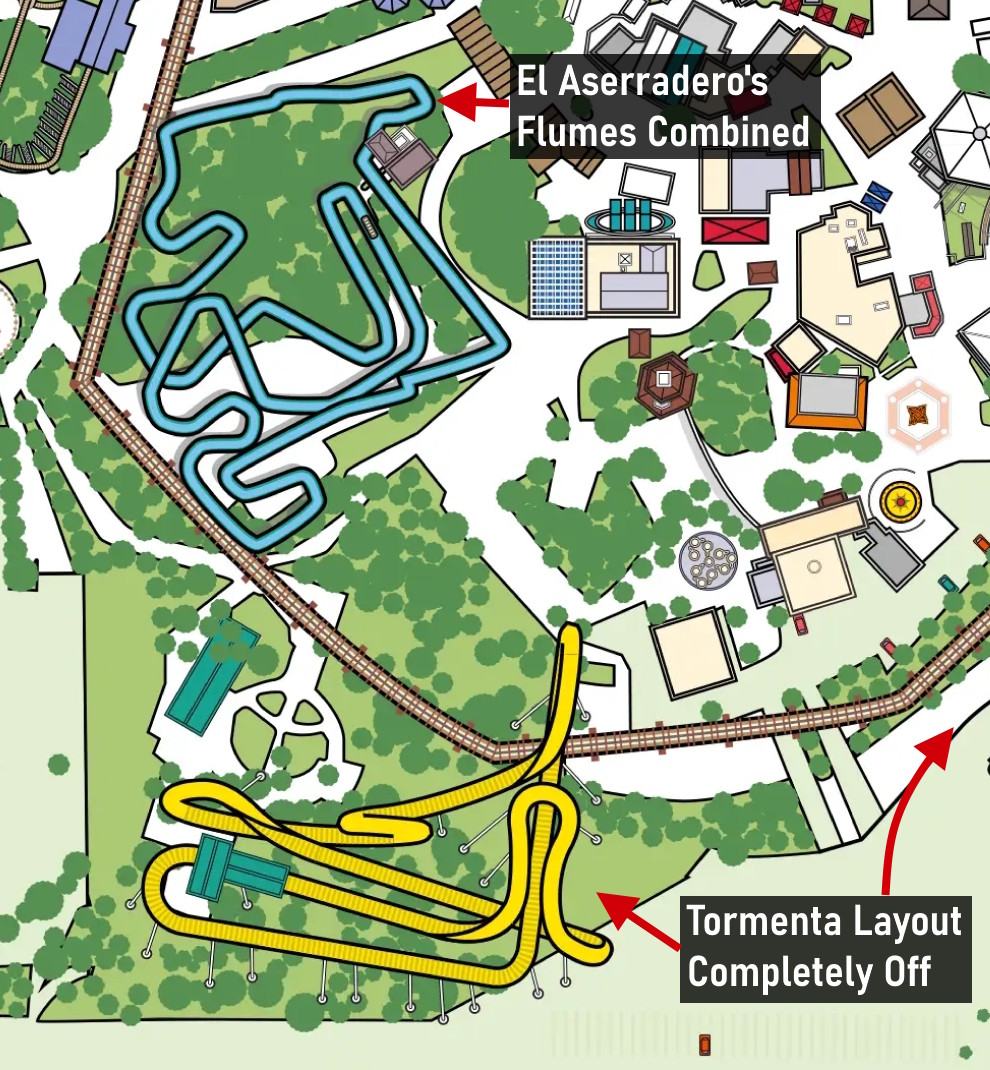
Tormenta's layout is completely misplaced/oriented and El Aserradero's two flumes are combined into one
These are only a few of the issues we found, all of which support the theory that this map was haphazardly generated by AI. To be clear, this isn't simply an anti-AI stance. We see the problem when AI is used without human oversight, especially on a park map that incorrectly marks massive backstage areas as guest-accessible walkways and generally creates a visually confusing mess of a park map. And before anyone accuses us of being overly critical, we tend to think the least a map can do is get the pathing correct. If Google Maps listed sidewalks and hiking trails as roads, surely its usefulness for drivers would plummet.
But At Least It Got the Areas Correct, Right?
Beyond the graphical issues, this map is also up to old shenanigans when it comes to the park's areas. The guide lists just 5 park areas: Spain & Mexico, Texas, Tower, Gotham, and Boomtown. Missing are the Old South & France and USA areas, with Texas or Boomtown absorbing all the attractions within these unlisted areas. You might believe these aren't actually distinct areas anymore, but on the official website's attraction list, it still lists ones within France and USA areas. SFOT's park areas being inconsistently listed on maps and questioning if they even exist anymore is something we've covered before.
Initially it seemed like this new map would be limited to the app, but in early summer they began appearing throughout the park as well, cementing the fact that these are indeed the new maps for 2026 (at least for now).
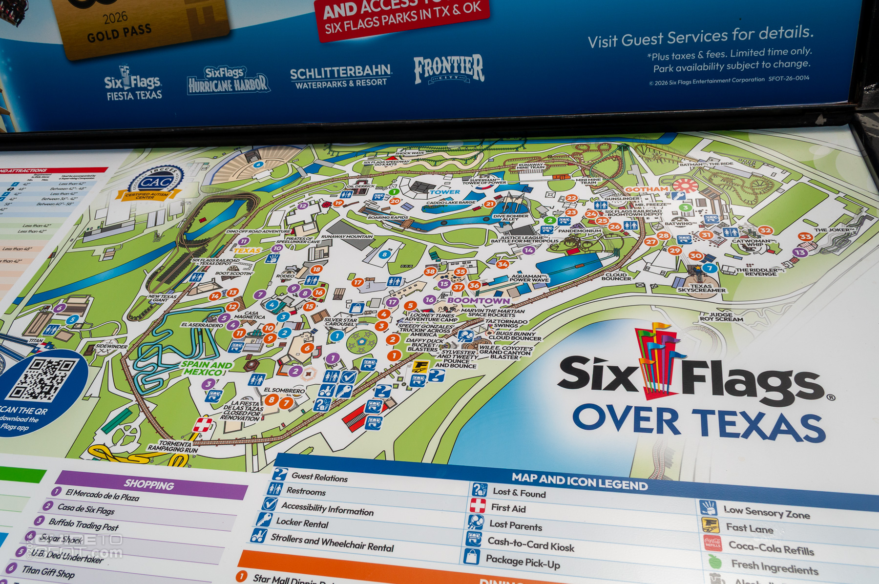
2026 Park Map installed at the Park
Introducing our New Interactive Park Map
Highlighting the numerous issues with SFOT's latest park map was not our initial goal, rather it was a side effect of us starting to develop a new, custom, interactive Six Flags Over Texas map several months ago. A map that we are finally ready to present to the public today.
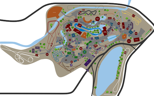
Map Thumbnail
Previously we used a custom Google Maps version for our site's park map, but it lacked the visual customizations, features, and interactivity we desired. We set out to create our own SFOT map that could be customized with different layers to be as useful as possible to park visitors. One where you can click on any ride or shop to find out more information, or search for facilities like first aid or restrooms. And one where you can click on a dining location and get a direct link to its menu (did I mention we have updated every dining location in the park to list its current menu this season?).
The interactivity doesn't stop there. We've also completely overhauled all of GuideToSFOT's pages for Rides, Dining Locations, and Shops to have other useful information (including ride alerts for attractions with extended downtimes or other special situations), and all now include a "Find on Map" button that will show exactly where it is on the map. In fact our Rides page now lets you filter rides by category, location, or our favorite, by height requirement, to quickly list the attractions your family can enjoy.
Our new park map took dozens of human hours to create. It has a basic appearance but still depicts tracked rides true to life and most importantly, accurately depicts guest pathways for navigation.
I don't want to admit how many hours of work these new features have taken over the past 3 months, but hopefully you'll find them useful enough to use, enjoy, and recommend to others. And hopefully the park works to improve its official park map, and show it some of the love the rest of the park has been seeing over the past several months. Surely the original Six Flags park is worthy of a legitimate map.
If you come across issues or have suggestions for improving our new park map and other pages, please let us know, either on the page's comments or through our Contact Form.


0 Comments